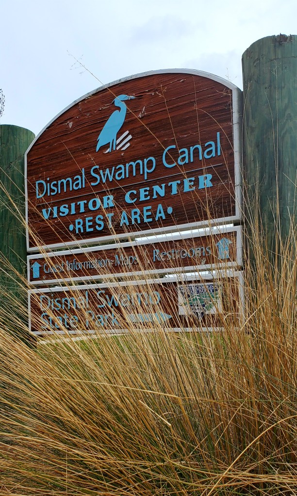
We’re here! I’ve been looking forward to this for a long time, having heard about it for decades. We had to time it right to arrive at the southern lock at opening time, since the two locks that book-end the canal open on a schedule. We traveled in a parade of three boats…a Nordic Tug in the lead, Mainship (us) in the middle, and a catamaran at the end. We slowed as needed to time our arrival at the lock, and Jeff said it was “slowest 23 miles we’ve ever done.” I didn’t mind! We successfully navigated the peculiar lock and successfully dodged storms — happy to let Yooper Too (the tug) take the lead, as he’s done this run before — and tied up at the Great Dismal Swamp Visitors’ Center (free dock) at Intracoastal Waterway Mile Marker 28 (ICW MM28) in North Carolina before 1 p.m.
It’s an unusual stop for boats. The busy Highway 17 runs alongside the canal here, so the Visitor’s Center is also a kind of truckers’ stop and roadside park. But it’s not noisy, and we have access to the clean bathrooms. The folks staffing the center are helpful, as the reviews suggested they would be. (It’s always nice when reviews are accurate.) We’re disappointed that the state park right across the canal, and its trails, are closed now but made the best of a relaxing afternoon and evening, in between bouts of rain and wind gusts – grateful that the most extreme winds and thunderstorms passed just north of us.
Construction of this canal began in 1793. (!!) It took 12 years to build, through hand labor, provided mostly by slaves. It’s the oldest operating artificial waterway in the U.S. and is rich in both history and folklore. The Underground Railroad ran through here, and the swamp thus became home for escaped slaves who created communities called “maroons,” safe (mostly) from discovery by the surrounding swamp. The 22-mile canal is still maintained by the Army Corps of Engineers at a 6-foot (minimum) depth — although we saw mostly 7-7.5 feet. This depth is the reason why Looping boats with a deeper draft than ours generally take a different route. The Atlantic Intracoastal Waterway splits in Albemarle Sound, where bigger boats take a more easterly route and we lucky “small boys” get to head directly north. Into the swamp. Norfolk tomorrow!! Photos and captions below.
PS: The word “dismal” is an old word for swamp. But one can imagine the earliest explorers also found it dismal, especially in the summer. Bugs!
As we left Elizabeth City, we immediately began to see the swamp-like vegetation.
As we neared the canal and the waterway began to narrow, we passed through this “cattle gate.” The entrance wasn’t much wider than our boat.
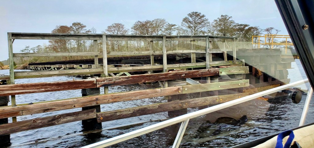
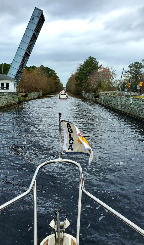
There’s not only locks, but also bridges, on the Great Dismal Swamp Canal. Yooper Too passed through in front of us.
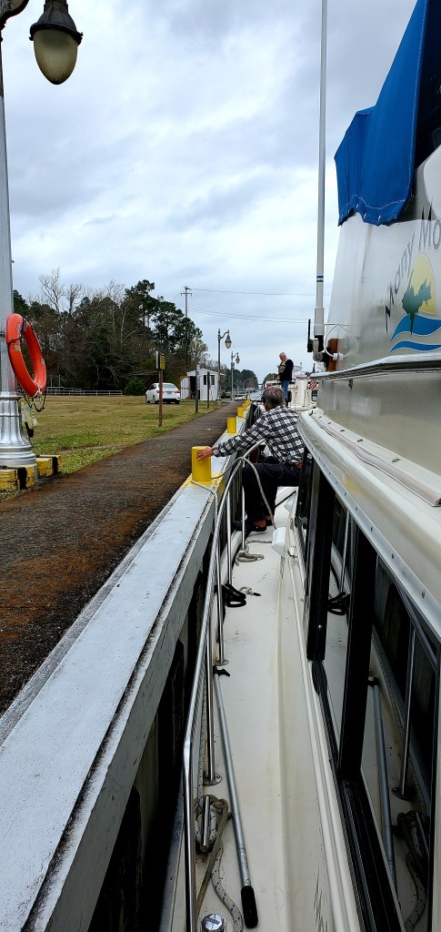
We’ve been through more than 30 locks but this one was tricky because of gusty winds, an odd tie-up (immovable bollards) and the accent of the lock worker who helped grab our lines with a boat hook! Jeff is hanging onto the bow line here while I have the stern line. We are near the top of the lock here, after it’s filled with water, but we were much lower than this when we entered.
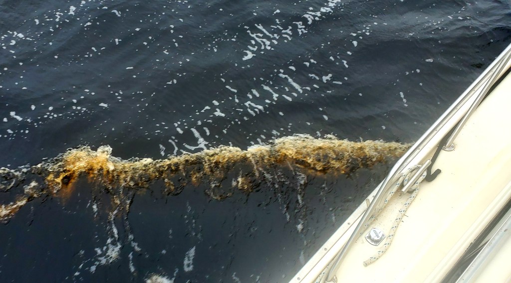
The water is very brown here, due to tannic acid from the trees. They say it is nonetheless “pure.” And fresh water! Nice after the weeks of salt water spray.
Tranquility behind us in the lock after the water rose about 10 feet.
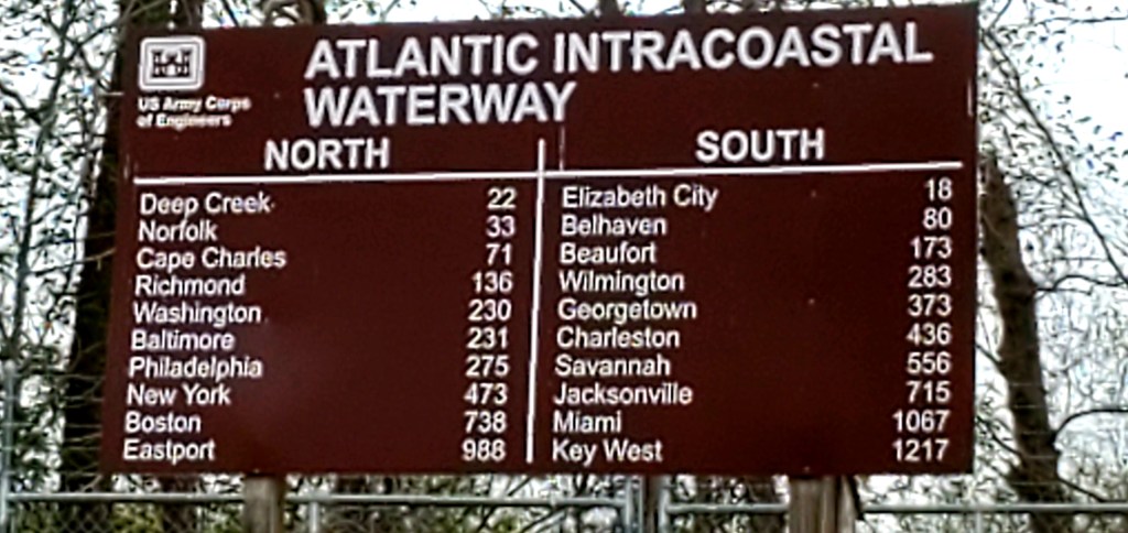
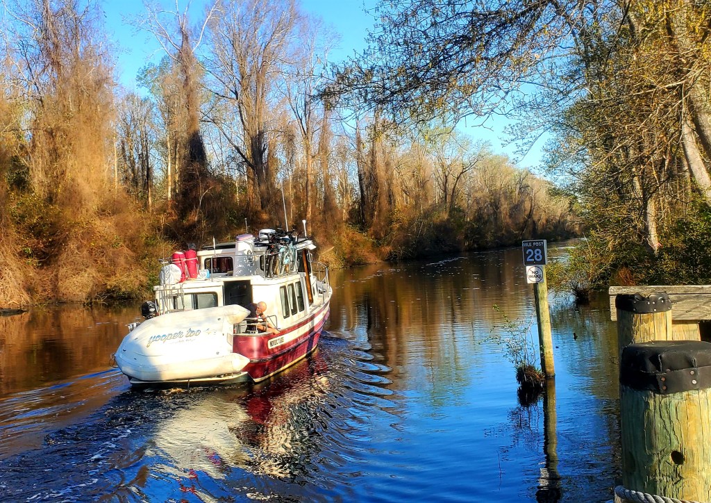
This sign after the lock shows the distance to various destinations. The first time we’ve seen this on the ICW.
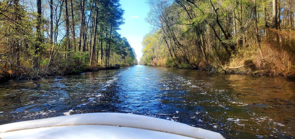
The canal was very windy before it got stick-straight, reminding us of the Tenn-Tom leading to the Gulf of Mexico.
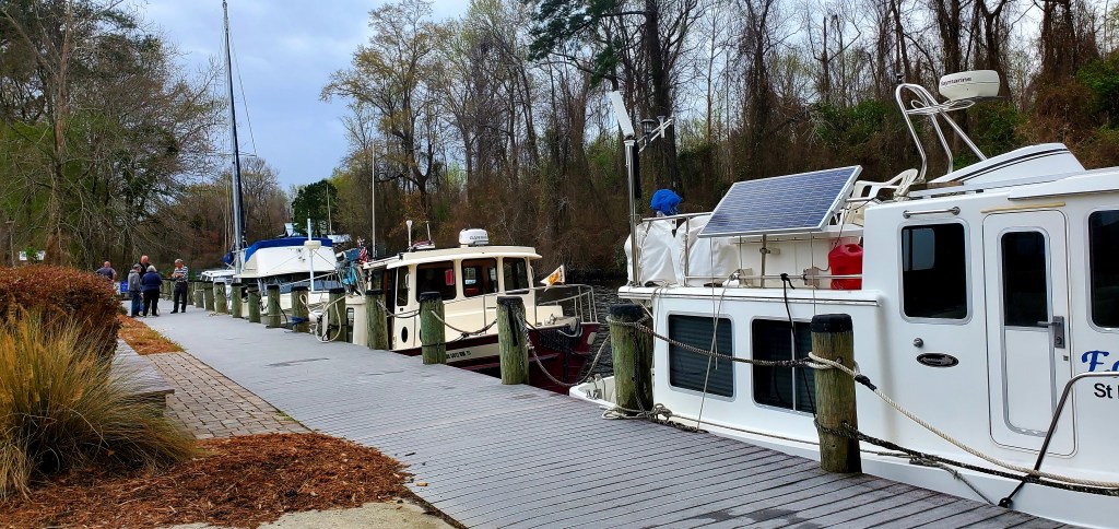
Edith B, Yooper Too, Many Moons and Tranquility secured to the dock at the Dismal Swamp Visitors’ Center. The dock fits four boats, but we’ve heard of 16 tied here, rafted four boats out.
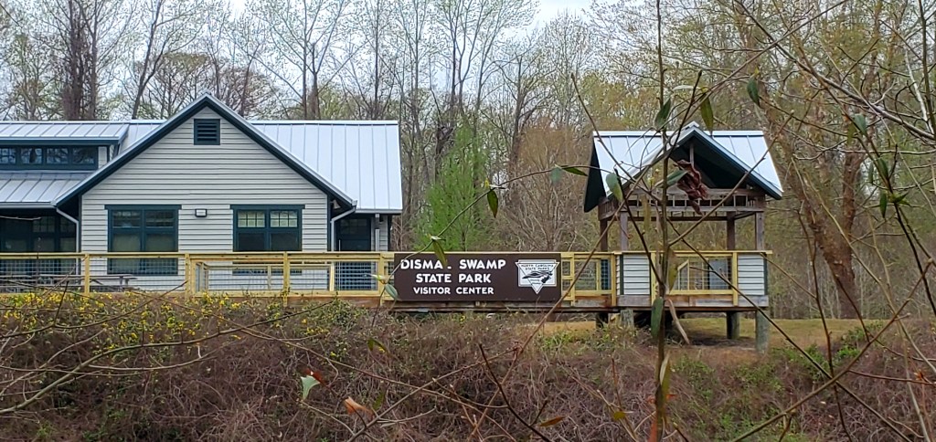
It’s a modest Visitors’ Center, but nicely stocked with brochures and maps. And clean restrooms!
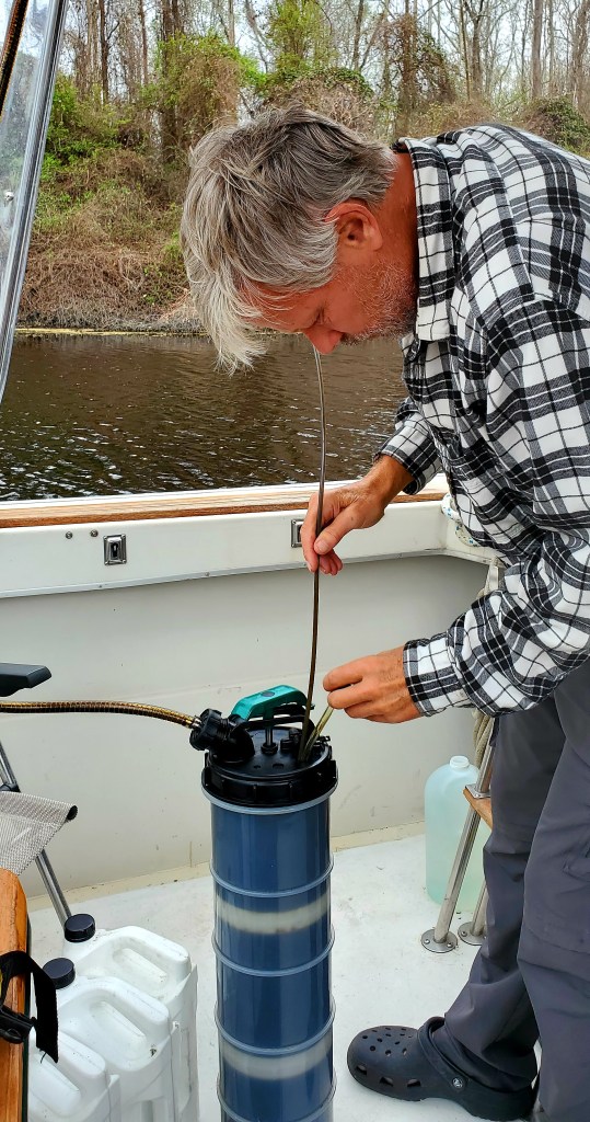
Jeff busied himself with an oil change (every 1,500 miles!) and didn’t need my help, so I went exploring by bike.
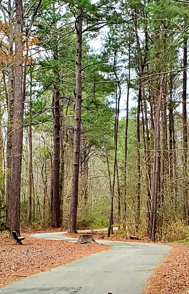
The 3-mile (one-way) paved path at the visitor’s center is quite nice, but I didn’t like that it bordered the busy highway.
The dock here is higher than the boats, as you can see.
Right across from the visitor’s center, the state park was closed.
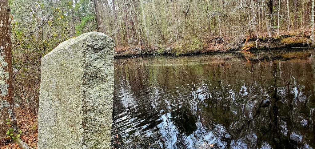
Stone distance markers dating back to the 1800s have been resurrected and re-placed on the side of the canal. (The distance number faces the canal, not me, as I take this picture.)
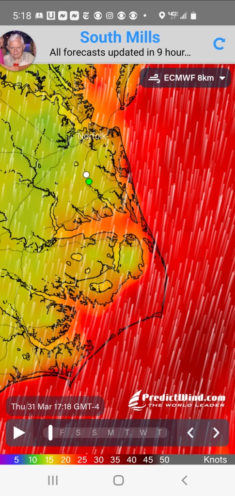
Meanwhile, look at the winds all around us! (Deep red means above 35 mph.) We are at the white dot.
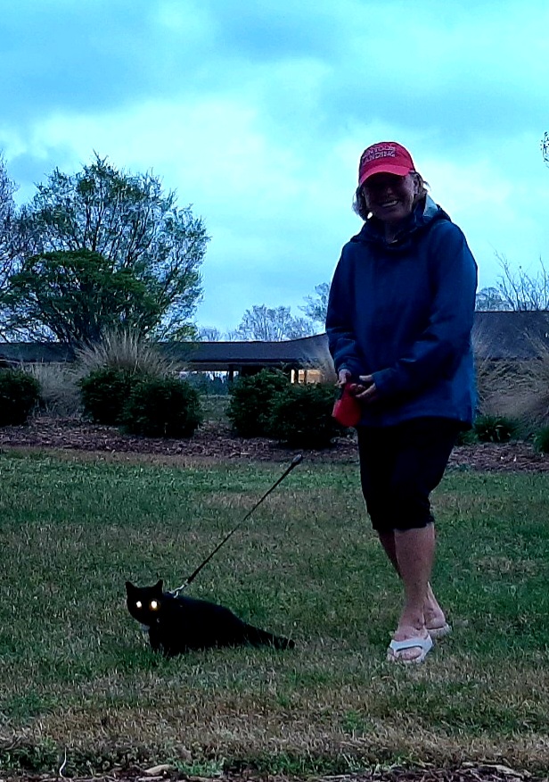
Taking Boo on her nightly walk. The visitors’ center is behind me. After our walk, she bolted from the boat but returned within 15 min. She knows where the treats are! (And the love.)
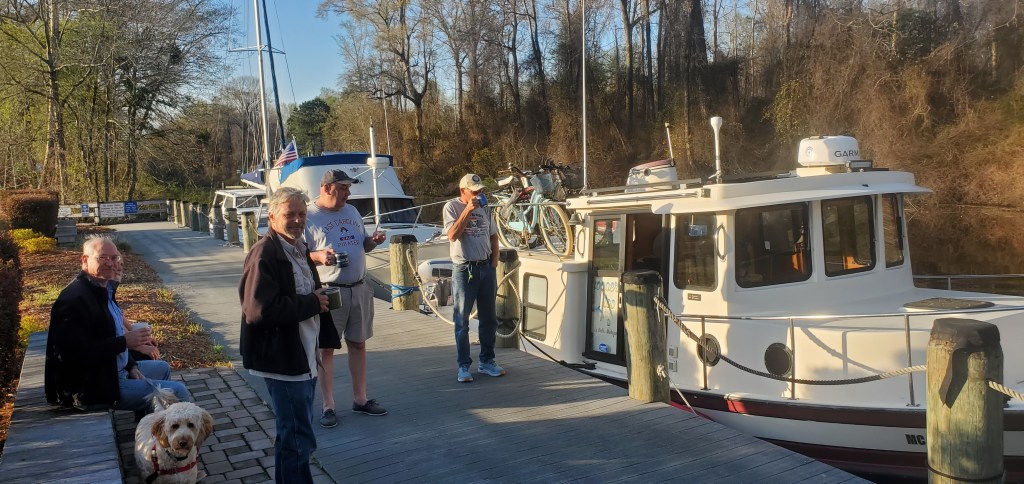
Morning coffee on the dock before pulling out.
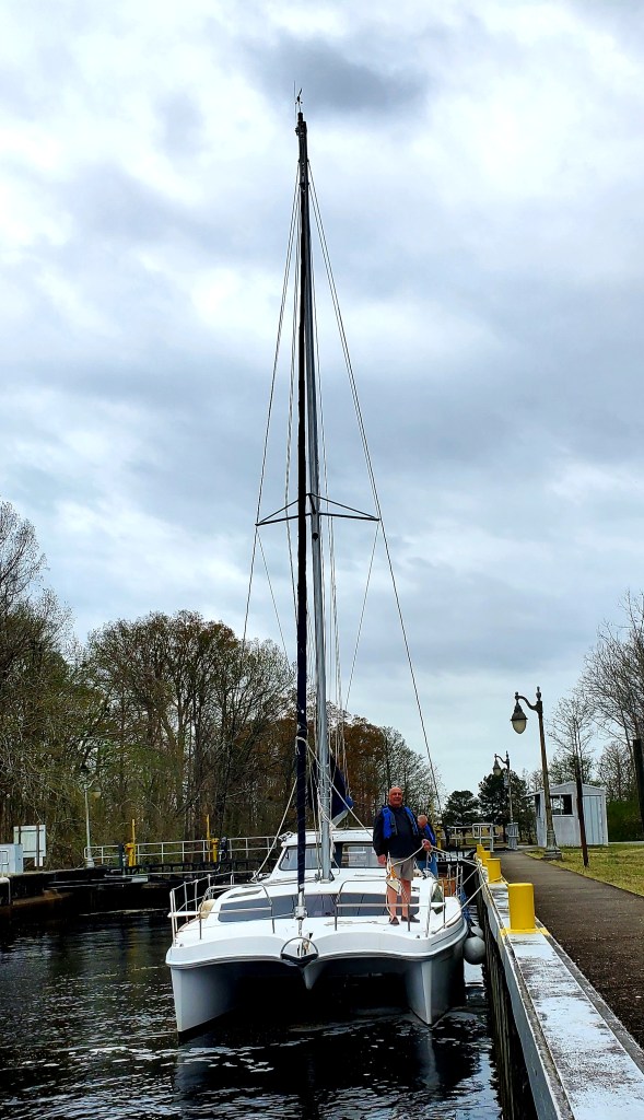
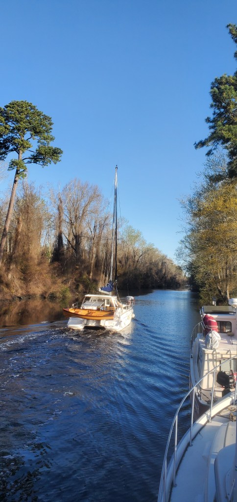
Tranquility pulled out first. As a catamaran, she has a shallower draft than many sailboats so can navigate this canal.
Yooper Too pulled out next and we took up the rear. What fun it’s been to get to know Skipper Brian, who was raised just 12 miles north of where I was born. Jeff and I are “Yoopers” too…people from Michigan’s Upper Peninsula…but to meet a Yooper from close to home, who is also doing The Great Loop and is also is 100% Finnish by DNA…fun! We exchanged a few Finn phrases by radio during our slow voyage today.
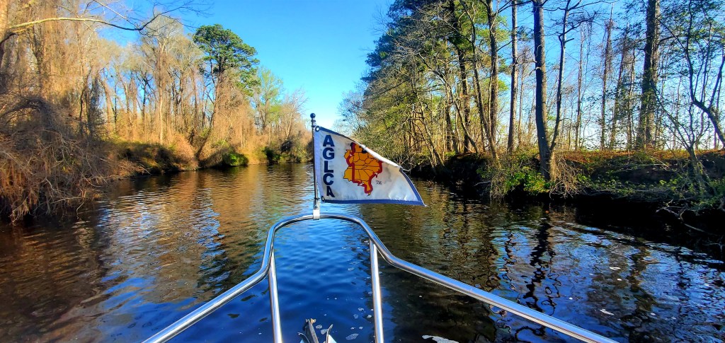
As we cruised on, the canal got more and more narrow. The trees are just starting to bud as we approach the Virginia state line on the last day of March. (Virginia tomorrow!)
I’m so glad to be here, and sorry for the bigger boats that can’t see this piece of national history.
I was born and raised in Houghton and recently moved to Manistee, but from 1996 to 2004 we lived in Elizabeth City and from 2004 to 2020 we lived in Edenton. It was great seeing your pictures and reading what you wrote about the area.
Interesting bit of info and scenery. I plan on starting the loop this year. Only able to do short stretches 2-5 hundred miles at a time. Looking forward to seeing the sites and meeting the people
Probably 2 nights. We are at High Street Landing in Portsmouth tonight. Planning to take the ferry over to Norfolk at some point today or tonight. Probably best to communicate by email. My email address is on this blog. (marjasisu@gmail.com). Would be so fun to see you!


Interesting cuz Brian is my son in law….wd love to be on part of the loop.
LikeLike
I was born and raised in Houghton and recently moved to Manistee, but from 1996 to 2004 we lived in Elizabeth City and from 2004 to 2020 we lived in Edenton. It was great seeing your pictures and reading what you wrote about the area.
LikeLike
Have made this run. Favorite part of a trip north.
LikeLike
We love it too. Especially now that the sun is out as we leave the visitor center
LikeLike
Interesting bit of info and scenery. I plan on starting the loop this year. Only able to do short stretches 2-5 hundred miles at a time. Looking forward to seeing the sites and meeting the people
LikeLike
Hey,
How long are you in Norfolk??
I’d love to meet the 3 of you!
R/ Jim
LikeLike
Probably 2 nights. We are at High Street Landing in Portsmouth tonight. Planning to take the ferry over to Norfolk at some point today or tonight. Probably best to communicate by email. My email address is on this blog. (marjasisu@gmail.com). Would be so fun to see you!
LikeLike
Are you in Norfolk?
R/ Jim
LikeLike
Yes we are. In Portsmouth. For probably two nights.
LikeLike
We will remain at high street landing tonight (Portsmouth)
LikeLike